HOME >> CHINA
New drones commissioned for civilian disaster relief
Source:Global Times Published: 2020/1/22 18:08:40

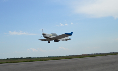
A Yaoying, or Harrier Hawk, drone takes off at an airfield. Photo: Website of Aviation Industry Corporation of China
The National Disaster Reduction Center of China has acquired a fixed-wing drone with plans to set up an emergency monitoring mechanism for serious disasters.
In a signing ceremony and technology symposium, the Ministry of Emergency Management disaster reduction center signed a cooperation agreement with the Guizhou Aircraft Industry Corporation, a division of the state-owned Aviation Industry Corporation of China (AVIC), according to a statement AVIC released on its Sina Weibo account on Tuesday.
The agreement will see the Yaoying drone enlisted for China's drone emergency monitoring program.
With a wing span of 10 meters, the 6-meter-long Yaoying can carry about a 100 kilogram payload that includes cameras and a synthetic aperture radar, according to the AVIC website.
The drone has a maximum speed of 230 kilometers an hour, a cruise speed of 170 kilometers an hour, a ceiling of 7,500 meters and an endurance of more than 12 hours.
After its first flight in August 2008, the Yaoying has accomplished missions including the surveying and mapping of the Sichuan Province-Tibet Autonomous Region border area in Southwest China, a location dubbed "Death Valley" by AVIC in Tuesday's statement.
This proved the Yaoying is capable of conducting missions in complicated terrain and weather, the statement said, noting that the drone can provide effective mapping, emergency rescue, geological hazard surveys and aerial planning even in special environments like plateaus.
The drone is expected to conduct high-risk emergency rescue missions in western, mountainous areas, AVIC said.
A new entry to the Yaoying drone family, the Yaoying-2, made its maiden flight in July 2018, the Xinhua News Agency reported.
Unlike the civilian-use Yaoying, the Yaoying-2 is a military drone that can be used in reconnaissance and air-strikes, Xinhua reported, noting that the new entry can also conduct firefighting, disaster relief, aerial photography, oil pipelines, forest fire prevention and land resource survey missions.
Global Times
Posted in: SOCIETY