Nepal parliament vote steps up border dispute with India
Source:AFP Published: 2020/6/14 18:08:40

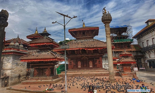
Photo taken on May 5, 2020 shows the Hanumandhoka Durbar Square during the nationwide lockdown in Kathmandu, Nepal. (Photo by Sunil Sharma/Xinhua)
Nepal's lower house of parliament on Saturday approved a new national emblem with a controversial political map that includes strategic territories disputed with its giant neighbor, India.
With relations between the two strained by their frontier squabble, India quickly hit back saying the action was "not tenable."
The two have been wrangling since India in May opened a new 80-kilometer road in Uttarakhand state leading up to the disputed Lipu Lekh pass.
Nepal condemned the move and its cabinet decided to publish a new political map that includes Lipu Lekh and contested zones in Kalapani and Limpiyadhura.
An amendment bill for a revised national emblem to include the new map was passed by the House of Representatives on Saturday. Speaker Agni Prasad Sapkota said there were no votes against.
The amendment will have to be endorsed by the National Assembly and the president before it is implemented.
The neighbors are wrangling over a region of more than 300 square kilometers where the Nepali and Indian borders touch China.
Nepal claims the Lipu Lekh under an 1816 treaty that sets the boundary with India along the Kali River. Disputes have arisen because neither side can agree on its source.
Nepal claims the adjoining Kalapani region even though Indian troops have been deployed there since India and China fought a border war in 1962. Nepal has since deployed security forces close to Kalapani.
Nepal and India have agreed to hold talks on the dispute but Kathmandu says its neighbor will not set a date.
Following Saturday's vote, India's foreign ministry spokesman Anurag Srivastava said: "The artificial enlargement of claims is not based on historical fact or evidence and is not tenable."
AFP
Posted in: CENTRAL & SOUTH ASIA