Typhoon Saola is approaching eastern Taiwan

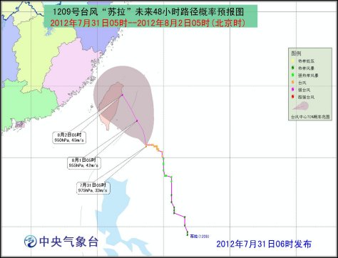
At 6:00 am Tuesday, typhoon Saola was centered about 410 km southeast of Hualian, Taiwan province with maximum wind force up to scale 12 near its center.
Saola is forecasted to move north by west at speed of 5-10 km per hour with gaining intensity approaching eastern Taiwan gradually.
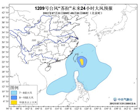
Affected by the typhoon, in the next 24 hours from 8:00 am Tuesday, there will be gale with force scale up to 8-10 affecting east of Taiwan. Maximum wind force will occur up to scale 11-14 and gust up to 15-16 near its center. And high wind with scale 7-8 and gust up to scale 9-11 is forecasted to happen in Bashi Channel, Balintang Channel, Taiwan Straits, eastern and southern South China Sea, southern East China Sea, Taiwan coast, and coastal Fujian. Taiwan will be hit by heavy rain or rainstorm and isolated severe rainstorm.
At the same time, the 10th tropical storm Damrey has increased into a seere tropical storm in this morning. At 5:00 am today it was centered about 860 km south by east of Tokyo, Japan with maximum wind force up to scale 10. It is forecasted to move west by north at speed of 30 km per hour with gaining intensity. In the coming 24 hours it will not affect off shore of China.
