US spy ship conducts extensive activities in S.China Sea, 'aims to collect data to support submarine warfare against China'

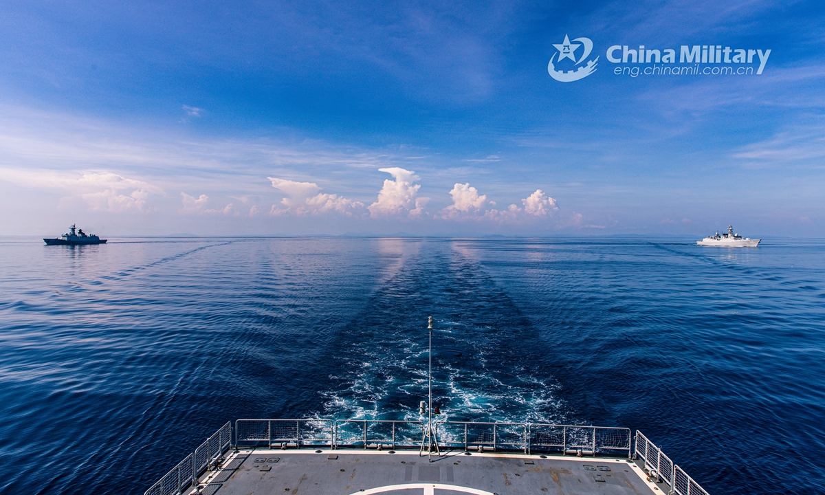
The guided-missile destroyers Hohhot (Hull 161) and Wuhan (Hull 169), together with the guided-missile frigate Hengyang (Hull 568), steam in formation in an undisclosed sea area during a 4-day maritime real-combat training exercise on September 2, 2020. All the warships are attached to a naval destroyer flotilla under the PLA Southern Theater Command. (eng.chinamil.com.cn/Photo by Li Wei)
A US Navy oceanographic survey ship has been conducting extensive activities in a large area of the South China Sea since late September, which Chinese military experts said aims to collect underwater geographical and hydrological data to support its submarine warfare in the region against China.
This situation also drew attention from some military observers after a US nuclear-powered attack submarine struck an unidentified underwater object in the South China Sea earlier this month, which again highlighted the US Navy's need to learn more about the region.
The USNS Mary Sears (T-AGS 65), a Pathfinder-class oceanographic survey ship, entered the South China Sea on September 26 and started extensive surveys, the South China Sea Strategic Situation Probing Initiative (SCSPI), a Beijing-based think tank, revealed on Sunday.
From October 1 to 4, the ship operated in waters south of China's Hainan Island, from October 5 to 9, it approached the coastline of Vietnam, and by Sunday it had arrived in waters near the Nansha Islands, according to the monitoring of the SCSPI.
Having operated in the South China Sea many times in the past, the Pathfinder-class oceanographic survey ship is specialized in the detection and surveying of underwater terrain, meteorology and hydrology, the SCSPI said, noting that this time, the ship covered a very large area in a short time, which is rare.
While the ship seems to be conducting scientific research, its true mission is to support submarine and anti-submarine warfare, as it can draw underwater maps that can help navigate friendly submarines, or place detection devices to help locate hostile submarines, a Beijing-based military expert told the Global Times on Monday on condition of anonymity.
The US Navy wants to always have updated, accurate maps of the South China Sea so its submarines can safely navigate without using their active sonar devices, making themselves stealthier, or they can find good locations for an ambush, the expert said.
While the USNS Mary Sears was operating in the South China Sea, the USS Connecticut, a Seawolf-class nuclear-powered attack submarine, struck an underwater object in the region on October 2, CNN reported on Friday.
While the object the submarine struck remains unknown, experts said the likely candidates include terrain, a whale, floating debris or another underwater vessel.
If the submarine indeed hit terrain, it means the sea map the submarine was using was outdated, and new terrain has formed without the US Navy's knowledge, analysts said, noting that the work of oceanographic survey ships could have avoided the accident.
Both the USNS Mary Sears' recent activities and the USS Connecticut's accident showed that the US' intensive submarine activities in the South China Sea, on China's doorstep, are a threat not only to the Chinese Navy if a conflict breaks out, but also to normal, civilian activities in peacetime, the expert said.
Zhao Lijian, a spokesperson of China's Foreign Ministry, said at Monday's regular press conference that the US should explain where exactly the submarine accident took place, whether it caused a nuclear leak or polluted the environment, and whether it would affect navigation and fishing safety.
"I want to stress that the root cause of the incident, which also poses a serious threat and significant risk to regional peace and stability, is the US' constant stirring up of trouble in the South China Sea over a long period of time," Zhao noted at Friday's press briefing.


