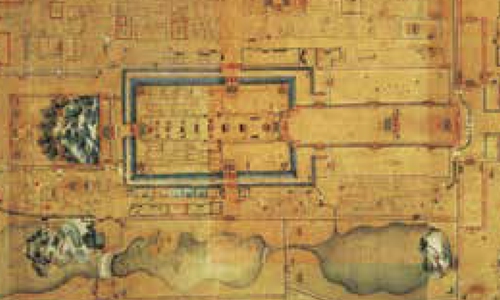
The Forbidden City and the central axis (part) in Map of the Capital's Inner City drawn in the late Qing Dynasty Photo: Courtesy of China Intercontinental Press
Beijing City of the Ming and Qing DynastiesProspect Hill north of the Forbidden City is worth mentioning. This hill was formed by piling the earth removed in digging the imperial palace's moat in the Ming Dynasty (1368-1644) and named Long Life Hill. It was commonly called Coal Hill and renamed Prospect Hill in the early Qing Dynasty (1644-1911). It was not only on the central axis, but also the commanding height in the city. Its main peak was located at the place of the Pavilion of Prolonged Spring, the imperial harem of the Yuan Dynasty (1279-1368). A hill was formed here to suppress the previous dynasty, so it was also called "Suppressing Hill" with profound meaning. In the Ming Dynasty, Beijing City's layout was also in strict accordance with traditional rites.
Apart from the Royal Ancestral Temple (for worshipping ancestors) to the front left (east) of the imperial palace and the Temple of Land and Grain (for worshipping the god of land and the god of grain) to the right (west), the Temple of Heaven, the Temple of Earth, the Temple of the Sun and the Temple of the Moon were built in the south, north, east and west respectively outside the inner city.
The streets and water systems in the city followed the planning system of Dadu City of the Yuan Dynasty. Most streets in the inner city were in parallel with two main roads to the left and right of the central axis, and all other streets were linked to these two main roads.
Because the imperial city, Shichahai Lake, the West Imperial Garden, etc. blocked connection between the east and the west, transportation between the east and the west was very inconvenient.
RELATED ARTICLES

