Chinese scientists reveal a significant underestimation of actual precipitation in the Qinghai-Xizang Plateau, call for new observation strategy
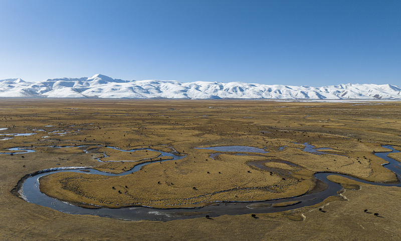
The photo taken on November 11, 2023 shows a pasture in Damxung County in Lhasa, Southwest China's Xizang Autonomous Region. Photo: VCG
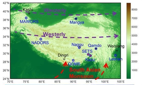
Chinese and foreign scientists including those from the Institute of Tibetan Plateau Research of Chinese Academy of Sciences, Beijing Normal University, Tsinghua University, Hohai University and the Utrecht University in Netherlands, propose a new precipitation monitoring scheme across the Tibetan Plateau, emphasizing instrument innovation, optimized site construction and spacing, and enhancing the integration of multiple monitoring methods, data assimilation, and deep learning techniques, the Global Times learned from the Institute of Tibetan Plateau Research (ITP), Chinese Academy of Sciences.
The Qinghai-Xizang Plateau, also known as the Tibetan Plateau and widely viewed as the Asian water tower, is home to over 100,000 square kilometers of glaciers and 1 million square kilometers of frozen soil. It serves as the source of 10 major Asian river systems flowing into 10 countries, and supports the lives of about 2 billion people.
In the context of accelerated warming, precipitation across the plateau plays a critical role in water cycles. Obtaining reliable precipitation information over the Qinghai-Xizang Plateau is a prerequisite for water cycle analysis, future climate projections, and water-related disaster risk assessments, scientists noted.
A joint study by Chinese and foreign scientists, including those from the Tibetan Plateau Research (ITP), Tsinghua University and Utrecht University in the Netherlands, proposes a new precipitation monitoring scheme for the Qinghai-Xizang Plateau, emphasizing instrument innovation, optimized site construction and spacing, multi-monitoring method integration, data assimilation, and deep learning techniques.
According to the study, the current ground-based instrument monitoring network in the plateau considerably underestimates actual precipitation. This underestimation is evidenced by discrepancies such as actual evapotranspiration exceeding precipitation, unrealistically high runoff coefficients, and accumulated snow water equivalent surpassing contemporaneous precipitation.
The scientists analyzed and identified the causes of this underestimation. According to Chiyuan Miao, a team member, the main reasons for this underestimation are instrumental errors caused by wind-induced gauge undercatch and representativeness errors due to sparse and uneven gauge density and the complexity of local surface conditions. Consequently, Xin Li, the team leader, called for a rethinking of previous conclusions regarding the water cycle and prompted the study to discuss potential solutions.
RELATED ARTICLES