Civil and commercial space forces contribute to disaster relief efforts in Xizang: CNSA

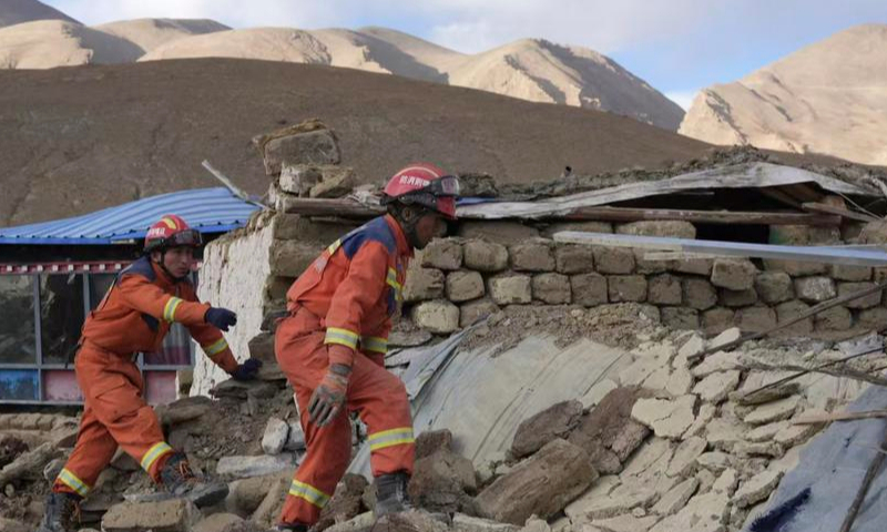
Rescuers work at a village in Dingri County in Xigaze, southwest China's Xizang Autonomous Region, Jan. 7, 2025. (Xinhua/Jigme Dorje)
After the deadly quake that struck Dingri County in the city of Xigaze, Southwest China's Xizang Autonomous Region on Tuesday, the China National Space Administration (CNSA)'s Earth Observation and Data Center immediately activated its emergency response mechanism with the participation of a number of civil and commercial space agencies, the administration said on Wednesday. The first batch of three remote sensing images and pre-disaster data have been shared with relevant authorities, it said.With the joint efforts of civil and commercial space forces, a multi-satellite joint emergency mission was planned and executed, the CNSA said. The center coordinated and dispatched units including the China Centre for Resources Satellite Data and Application, Spacety Co., Changguang Satellite Technology Co., and Minospace Co., to capture emergency imaging of the quake-hit county and its surrounding areas.
The Changguang Satellite Technology told the Global Times on Wednesday that in order to monitor the real-time situation, it urgently dispatched the Jilin-1 satellite to observe the affected regions. The satellite images were provided to relevant units immediately after capture to assist in earthquake relief efforts.
Dingri County's Cogo Township lies in the epicenter of the 6.8-magnitude earthquake. High-resolution images captured by the Jilin-1 satellite on Tuesday show that many houses in the township are made of adobe, which suffered significant collapses during the earthquake. Additionally, satellite images indicate that in Chamso Township, where buildings are primarily made of timber, the earthquake led to severe collapses because of poor seismic resistance.
The local government has actively set up temporary tents to provide shelter for the affected residents, the images showed.
The Jilin-1 satellite is China's first domestically developed commercial high-resolution remote sensing satellite. It has established the world's largest sub-meter level commercial remote sensing satellite constellation. This constellation can revisit any location on Earth 35 to 37 times a day, delivering comprehensive remote sensing data and services for agriculture, forestry, meteorology, oceanography, resources, environmental protection, urban construction, and scientific research, the Global Times has learned.
Global Times


